Volumes you can defend
Volumetrics disputes are expensive. Our workflow — DGPS-controlled drone capture, dense 3D surface reconstruction, toe/crest delineation and documented computation method — produces per-stockpile and pit volumes with the accuracy statement attached, so the number holds when questioned.
A typical quarry statement: four stockpiles, individually coloured and computed (12,450 / 8,320 / 15,600 / 9,870 m³), with total, area and average height per pile — plus the previous-survey comparison showing exactly what moved.
Beyond stockpiles
Excavation and dump quantities against approved plans, cut-fill heat maps for site development (52,430 m³ cut vs 48,120 m³ fill on a recent 12.5 ha site), haul-road condition mapping, lease-boundary compliance overlays and month-on-month progress reporting for management and statutory needs.
Fast, safe, repeatable
No crews climbing stockpiles: a site is flown in hours, and repeat surveys use the same control network — making monthly reconciliation genuinely comparable, not approximately so.
Deliverables you receive
- Per-stockpile volume statement with method & accuracy note
- 3D terrain & stockpile model (colour-classified)
- Cut-fill analysis maps and quantities
- Survey-to-survey progress comparison report
- Orthophoto of lease area with boundary overlay
- Data files: GeoTIFF, LAS/LAZ, DWG, PDF report
Specifications & standards
| Parameter | What we deliver |
|---|---|
| Volume accuracy | Typically within 1–3% (method-dependent, reported) |
| Control | DGPS GCP network, reused across surveys |
| Turnaround | Report in 3–7 days from flight |
| Comparison | Same-control repeat surveys, true deltas |
| Compliance | Lease boundary overlay & documentation |
| Formats | PDF report + GeoTIFF/LAS/DWG data |
Recent work
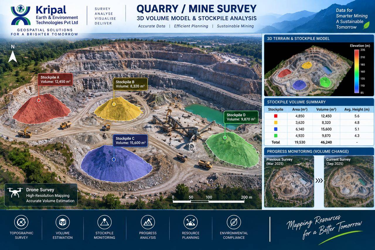 Quarry Survey & Stockpile Analysis
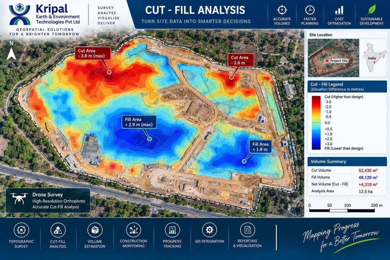 Cut & Fill Earthwork Analysis
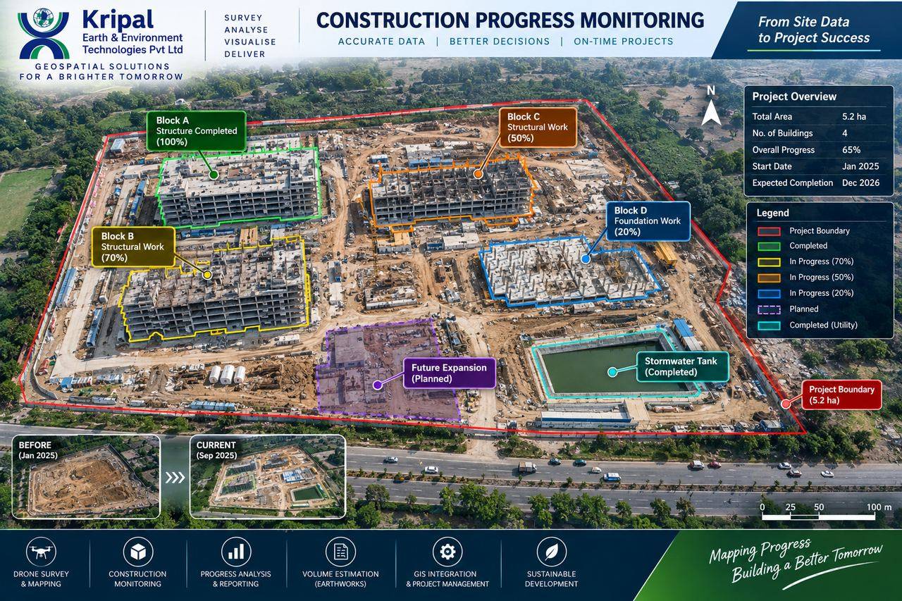 Construction Progress Monitoring