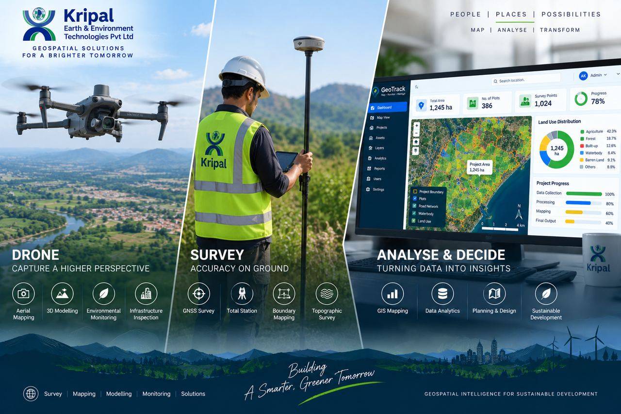
Bhubaneswar, Odisha  ·  Serving all India info@ke2technologies.com +91 93374 54754

We map the earth so you can decide with confidence

KE2 Technologies delivers survey-grade drone mapping, LiDAR, GIS platforms and environmental intelligence — turning terrain, assets and infrastructure into data your teams can act on.

~2–5 cmGround sampling distance on drone surveys
888 acresSingle-site township planned from one drone dataset
End-to-endAcquisition → processing → GIS → software
Govt + IndustryULBs, infrastructure, mining, forestry clients
DGPS-controlled workflows Survey-grade accuracy reporting Standard GIS-ready deliverables DGCA-compliant drone operations Custom Web GIS & MIS platforms
// OPEN-SOURCE PLATFORMS & TOOLS WE WORK IN
QGISGRASS GISGDALOpenDroneMapCloudComparePDALPostGISGeoServerLeaflet / OpenLayersPythonNode.js
About KE2 Technologies

Transforming spatial data into smart solutions

Most survey companies stop at data collection. Most software companies never touch the field. KE2 Technologies was built to close that gap.

Kripal Earth & Environment Technologies Pvt. Ltd. is a technology-driven geospatial company headquartered in Bhubaneswar, Odisha. We take projects from the first ground control point to the final decision-support dashboard — flying the drone, processing the point cloud, building the GIS database, and developing the web platform your teams use every day.

Our multidisciplinary team combines licensed surveyors, GIS analysts, remote sensing specialists and full-stack developers, working across infrastructure, mining, urban governance, forestry, agriculture and water resources.

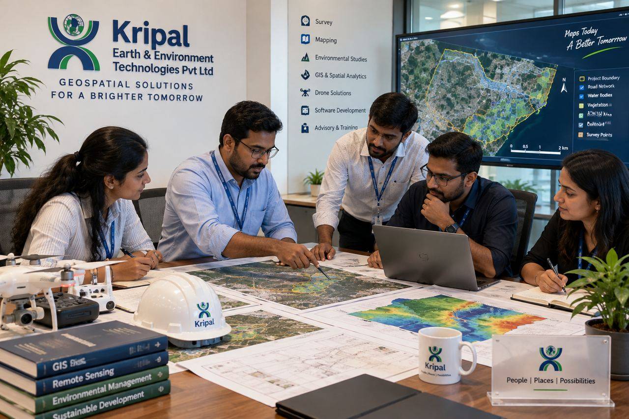
KE2 Technologies team reviewing drone survey maps and GIS outputs
Our surveyors, GIS analysts and developers work as one team — from field maps to final dashboards.
Drone / UAVLiDARDGPS & Total StationGIS & Remote SensingAI / ML AnalyticsWeb GIS DevelopmentCloud Platforms
Our Expertise

Nine capabilities. One integrated workflow.

Every service below can stand alone — but they're designed to chain together, so the drone survey feeds the GIS, and the GIS powers the software your team logs into.

🛰️FIELD → DATA

Aerial Survey & Mapping

High-resolution drone/UAV and LiDAR data acquisition with DGPS ground control.

  • Orthomosaic & photogrammetric mapping
  • DEM / DSM / DTM & contour generation
  • Stockpile volumes, cut & fill analysis
  • Corridor mapping & construction monitoring
Explore this service →
Deliverables: GeoTIFF ortho · LAS/LAZ point cloud · contours (DWG/SHP) · volume reports
Get a survey quote →
🗺️DATA → INSIGHT

GIS & Remote Sensing

Spatial databases and satellite analytics that turn raw data into answers.

  • GIS database design & asset mapping
  • LULC mapping & change detection
  • Thematic & QGIS Atlas map production
  • Satellite time-series & change analysis
Deliverables: GeoPackage/PostGIS DB · thematic map series (PDF) · analysis reports
Discuss your data →
📐GROUND TRUTH

Land & Engineering Survey

DGPS and Total Station surveys that anchor every project to verifiable control.

  • Topographical & boundary surveys
  • Route & alignment surveys
  • As-built & engineering surveys
  • Ground control networks for aerial mapping
Explore this service →
Deliverables: control point records · topo sheets · alignment drawings (DWG)
Plan a survey →
🌱ENVIRONMENT

Environmental Intelligence

Monitoring and assessment for forestry, watershed and natural resource programs.

  • Plantation survival & canopy analysis
  • Watershed & drainage analysis
  • Water resource & wetland mapping
  • Multi-epoch environmental change detection
Deliverables: CHM & crown maps · survival statistics · compartment-wise reports
Explore monitoring →
🏔️3D & TWINS

3D Mapping & Digital Twins

Real-world environments rebuilt as measurable, explorable digital models.

  • 3D terrain & city modelling
  • Point cloud classification & processing
  • Infrastructure & site digital twins
  • Surface analysis & 3D visualization
Deliverables: classified LAS · 3D mesh (OBJ/glTF) · web-based 3D viewers
See what's possible →
⛏️MINING & INFRA

Mining & Infrastructure

Repeatable geospatial intelligence for sites that change every week.

  • Mine surveys & stockpile calculation
  • Excavation & haul road monitoring
  • Road & railway corridor mapping
  • Periodic construction progress reports
Explore this service →
Deliverables: monthly volume statements · progress orthos · comparison surfaces
Set up monitoring →
💻SOFTWARE

GIS Software & Web GIS

Custom platforms that put your spatial data in front of the people who need it.

  • Web GIS portals & geoportals
  • MIS dashboards & asset management
  • Mobile field data collection apps
  • API integration & workflow automation
Explore this service →
Stack: Node.js · PostGIS · Leaflet/OpenLayers · role-based access · cloud or on-premise
Discuss your platform →
🌐DIGITAL

Website Development

Professional, responsive websites for businesses and institutions.

  • Corporate & institutional websites
  • E-commerce & landing pages
  • CMS development & redesigns
  • Hosting, maintenance & SEO support
Included: mobile-first design · SSL · analytics · lead capture · SEO setup
Build your website →
🎓CAPACITY

Training & Consultancy

Hands-on programs taught by professionals who run these workflows daily.

  • GIS, Remote Sensing & spatial analysis
  • Drone mapping & photogrammetry
  • QGIS & open-source GIS toolchains
  • Web GIS & LiDAR processing
Formats: institutional batches · government capacity building · corporate upskilling
Explore programs →
Deliverables & Accuracy

Know exactly what you'll receive

Every mapping engagement is scoped against clear specifications. Typical figures below — final specs are agreed per project based on site, altitude and control design.

← swipe to see all columns →

Survey TypeTypical ResolutionPositional AccuracyCore OutputsBest For
Drone Photogrammetry 2–5 cm GSD ±5–10 cm (with GCPs) Orthomosaic, DSM/DTM, contours, point cloud Townships, sites, R&R, progress monitoring
Drone LiDAR 100–400 pts/m² ±5–10 cm vertical Classified LAS, bare-earth DTM, CHM Vegetated terrain, corridors, forestry
DGPS / Total Station Point-based Centimetre-grade Control networks, boundary & topo surveys Legal boundaries, engineering design
Satellite Remote Sensing 0.3–10 m Scene-dependent LULC, change detection, time-series District/regional analysis, monitoring
GIS-MIS Platforms Web & mobile, role-based access Dashboards, asset registers, map services ULBs, departments, enterprises

// All aerial deliverables include flight logs, GCP/check-point reports and processing QC documentation.

How We Work

A transparent process, from brief to handover

This sequence stays the same whether the project is a 10-acre plot survey or a district-wide GIS platform — only the scale changes.

Scope & Plan

We define the exact question your data must answer.

  • Site recce & feasibility
  • Accuracy & deliverable spec
  • Flight & control design
  • Permissions & compliance

Acquire

Field teams capture data against DGPS ground control.

  • GCP network establishment
  • Drone / LiDAR flights
  • Ground survey verification
  • Same-day data QC

Process & Analyse

Raw data becomes verified, decision-ready products.

  • Photogrammetric / LiDAR processing
  • GIS database construction
  • Analytics & AI/ML models
  • Accuracy assessment report

Deliver & Support

Handover in your formats — plus the tools to use them.

  • Standard open formats
  • Web GIS / dashboard deployment
  • Team walkthrough & training
  • Update & monitoring cycles
Industries We Serve

Where our work makes decisions easier

Government & Urban Local Bodies

We build the spatial backbone for urban governance — from base maps to the MIS your officers use daily, delivered in departmental formats and aligned with schemes like AMRUT.

  • GIS-MIS platform development for NACs & municipalities
  • Property, asset & POI mapping
  • Ward & administrative boundary mapping
  • Drone-based base map generation
  • QGIS Atlas standardized map production
  • Departmental training & capacity building
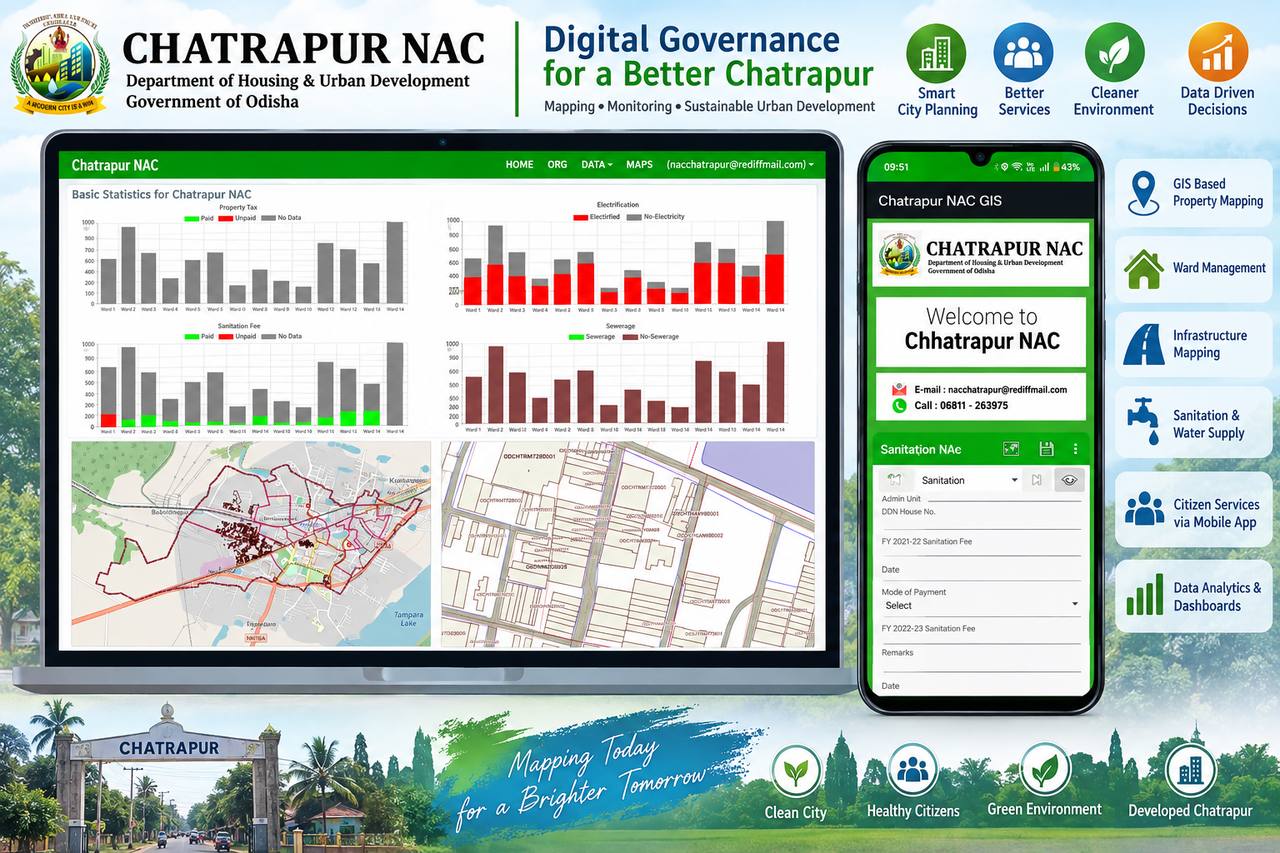
// Delivered: complete GIS-MIS with POI & boundary mapping for Chatrapur NAC, Ganjam district

Mining

Sites that change every week need surveys that keep pace. We run repeatable monthly drone cycles so your volumes, compliance and planning always reflect the ground today.

  • Stockpile volume calculation & reconciliation
  • Excavation & dump monitoring
  • Lease boundary & compliance mapping
  • Haul road condition mapping
  • Cut & fill and surface comparison
  • Periodic ortho & DTM updates
// Typical cycle: monthly flight → volumes within 48–72 hrs → signed statement with QC report

Infrastructure & Construction

From pre-bid topography to as-built handover, we give planners and engineers terrain truth at every project stage.

  • Pre-bid & DPR-stage topographical surveys
  • Township & site layout planning support
  • Construction progress orthomosaics
  • Earthwork quantification
  • As-built surveys & documentation
  • Drainage & utility integration mapping
// Delivered: 888-acre R&R township planned end-to-end — drone survey to 871-plot subdivision design

Forestry & Environment

Multi-epoch drone and AI analytics that turn plantations and forest blocks into measurable, monitorable assets.

  • Plantation survival rate monitoring (multi-epoch)
  • Canopy height models & vegetation density
  • Individual tree crown delineation & counts
  • Gap detection & encroachment monitoring
  • Compartment, road & waterbody mapping
  • Compartment/village-wise statistics & reports
// Per-tree detection from drone data: location, height and crown diameter for every stem

Water Resources

Drainage and watershed intelligence for cities and basins — survey-grade data structured for hydraulic modelling.

  • Storm water drainage network surveys
  • SWMM-ready drainage databases
  • Watershed delineation & analysis
  • Waterbody & wetland mapping
  • Flood-prone zone identification
  • DEM-based flow & suitability analysis
// Delivered: city-scale storm water drainage survey & GIS database for Paradip master planning

Agriculture

Field-level clarity for departments and agri-enterprises — from boundary mapping to damage verification workflows.

  • Field & plot boundary mapping
  • Crop assessment from drone & satellite
  • Crop damage assessment & verification
  • Irrigation command area mapping
  • Land use & cropping pattern analysis
  • Mobile field data collection apps
// GIS + drone + AI workflows designed for compensation-claim verification at scale

Roads, Railways & Utilities

Linear infrastructure lives and dies by corridor data quality. We map alignments with the accuracy engineering design demands.

  • Road & railway corridor mapping
  • Alignment & route surveys
  • LiDAR bare-earth terrain under vegetation
  • Right-of-way documentation
  • Transmission corridor & substation surveys
  • Network asset GIS for utilities
// Design-ready outputs: classified point clouds, DTM, contours and DWG alignment sheets
Project Showcase

Recent work, with the numbers that matter

A selection across drone survey, GIS, environment and software — each delivered end-to-end by our in-house team.

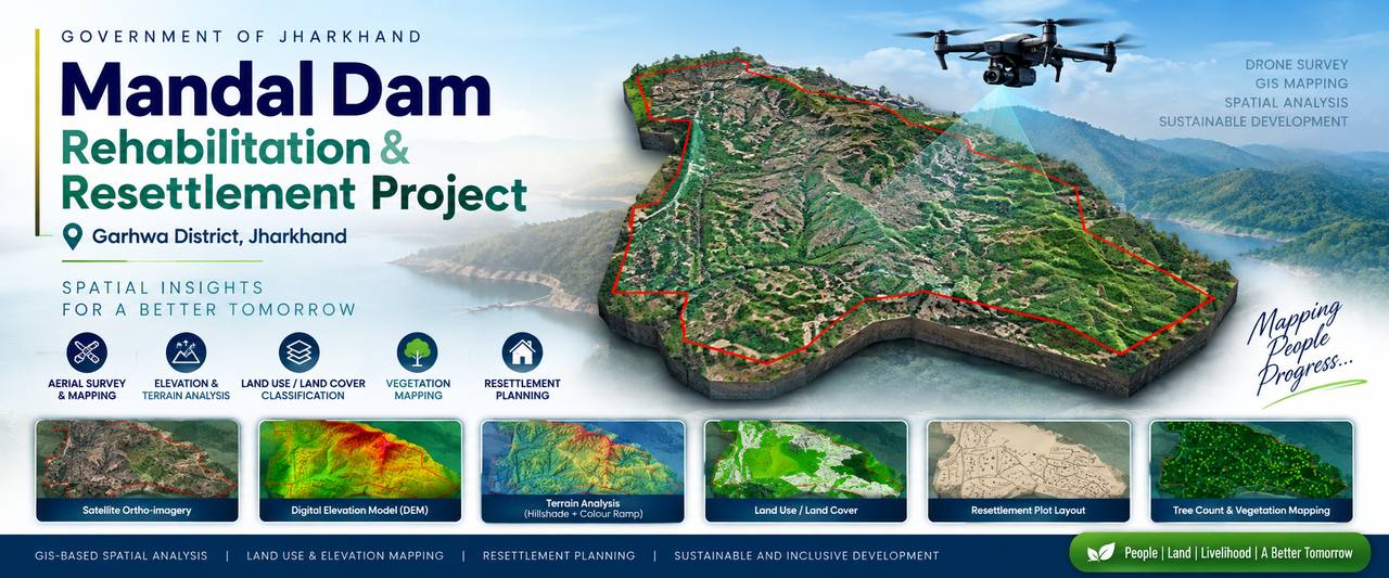
Mandal Dam Rehabilitation and Resettlement project drone survey, Garhwa district, JharkhandDRONE + PLANNING

Bisrampur R&R Township Planning

Mandal Dam R&R · Garhwa, Jharkhand

Drone survey with ~19 cm DTM/DSM, hydrological drainage analysis and complete plot subdivision design with internal road network.

888 acSite area
871Plots designed
19 cmDTM resolution
Chatrapur NAC digital governance GIS-MIS dashboard and mobile appURBAN GIS-MIS

Chatrapur NAC GIS-MIS

Urban Governance · Ganjam, Odisha

Municipal GIS-MIS with POI extraction, administrative boundary mapping and standardized QGIS Atlas cartographic outputs for ULB governance.

NAC-wideCoverage
AtlasMap production
MISIntegrated
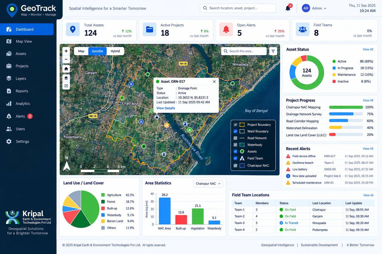
GeoTrack Web GIS dashboard with assets, layers and analyticsWEB GIS PLATFORM

GeoTrack — Web GIS / MIS Platform

Software · In-house Product

Full-stack platform on Node.js and PostGIS with JWT authentication and role-based access, built around live project survey data.

PostGISSpatial DB
RBACAccess control
Multi-projectArchitecture
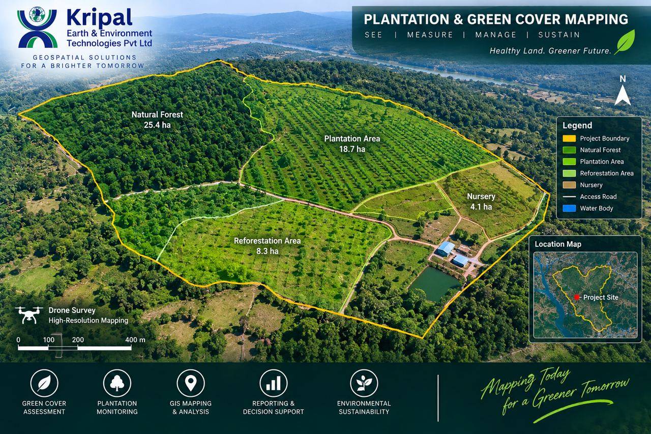
Plantation and green cover mapping from drone surveyFORESTRY AI

Plantation Survival Monitoring

Forestry · Multi-epoch Drone + AI

Two-epoch drone mapping with AI-assisted survival analysis: tree crown delineation, canopy height models, gap detection and compartment-wise statistics.

2 epochsPitting → growth
Per-treeDetection level
CHMCanopy metrics
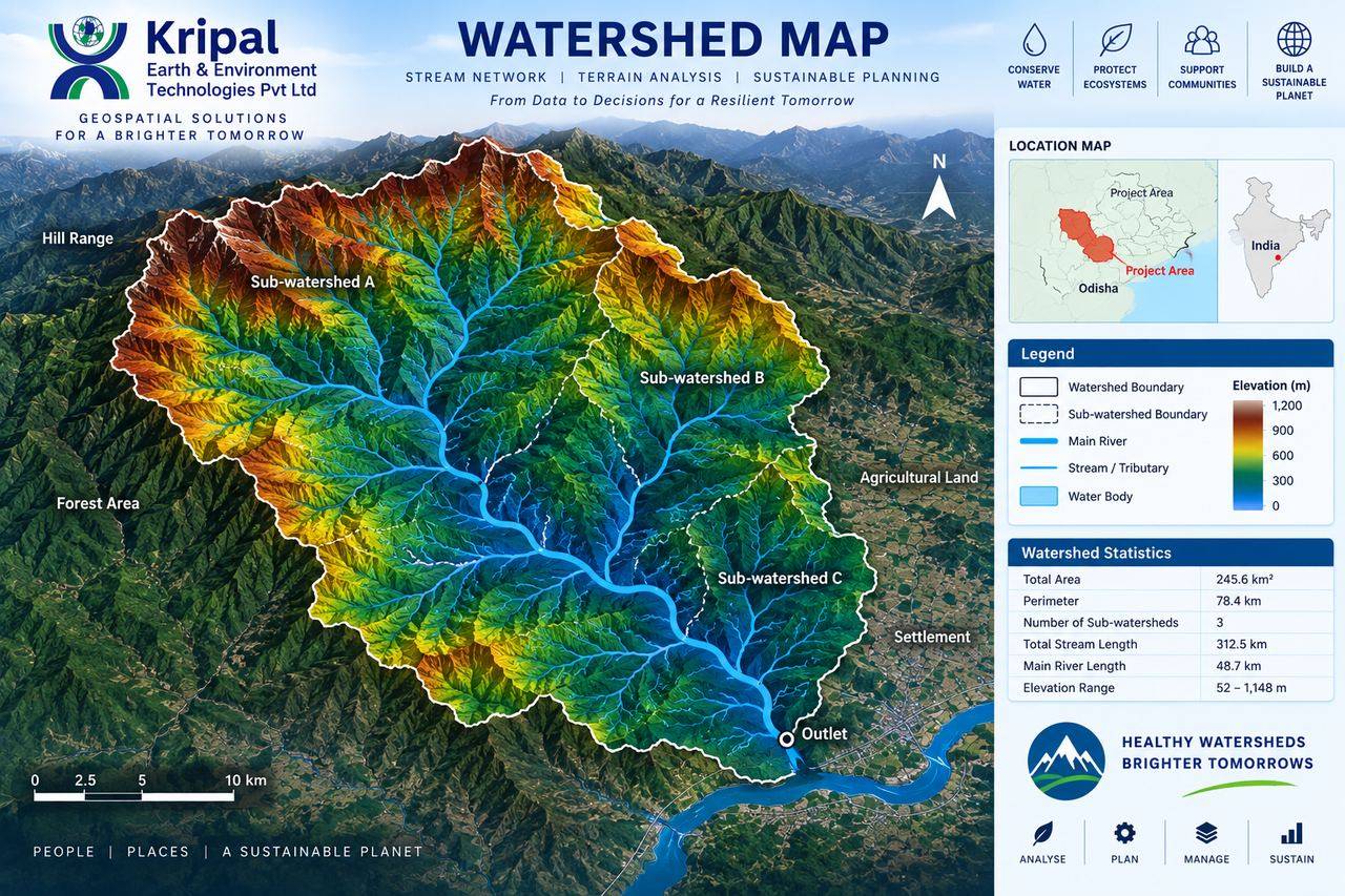
Watershed and stream network terrain analysis mapDRAINAGE

Paradip Storm Water Drainage Survey

Water Resources · Paradip, Odisha

Storm water drainage network survey and geospatial database supporting urban drainage master planning and design.

City-scaleNetwork
GIS DBDeliverable
SWMM-readyData model
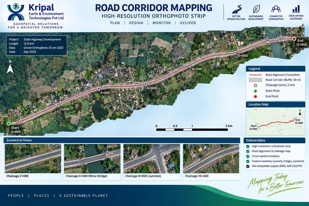
Road corridor high-resolution orthophoto strip with chainageLIDAR CORRIDOR

Corridor Mapping & Terrain Modelling

Infrastructure · LiDAR / Photogrammetry

High-accuracy corridor mapping with point cloud classification, bare-earth terrain modelling and contour generation for alignment design.

Bare-earthDTM under canopy
ClassifiedPoint cloud
Design-readyDWG output
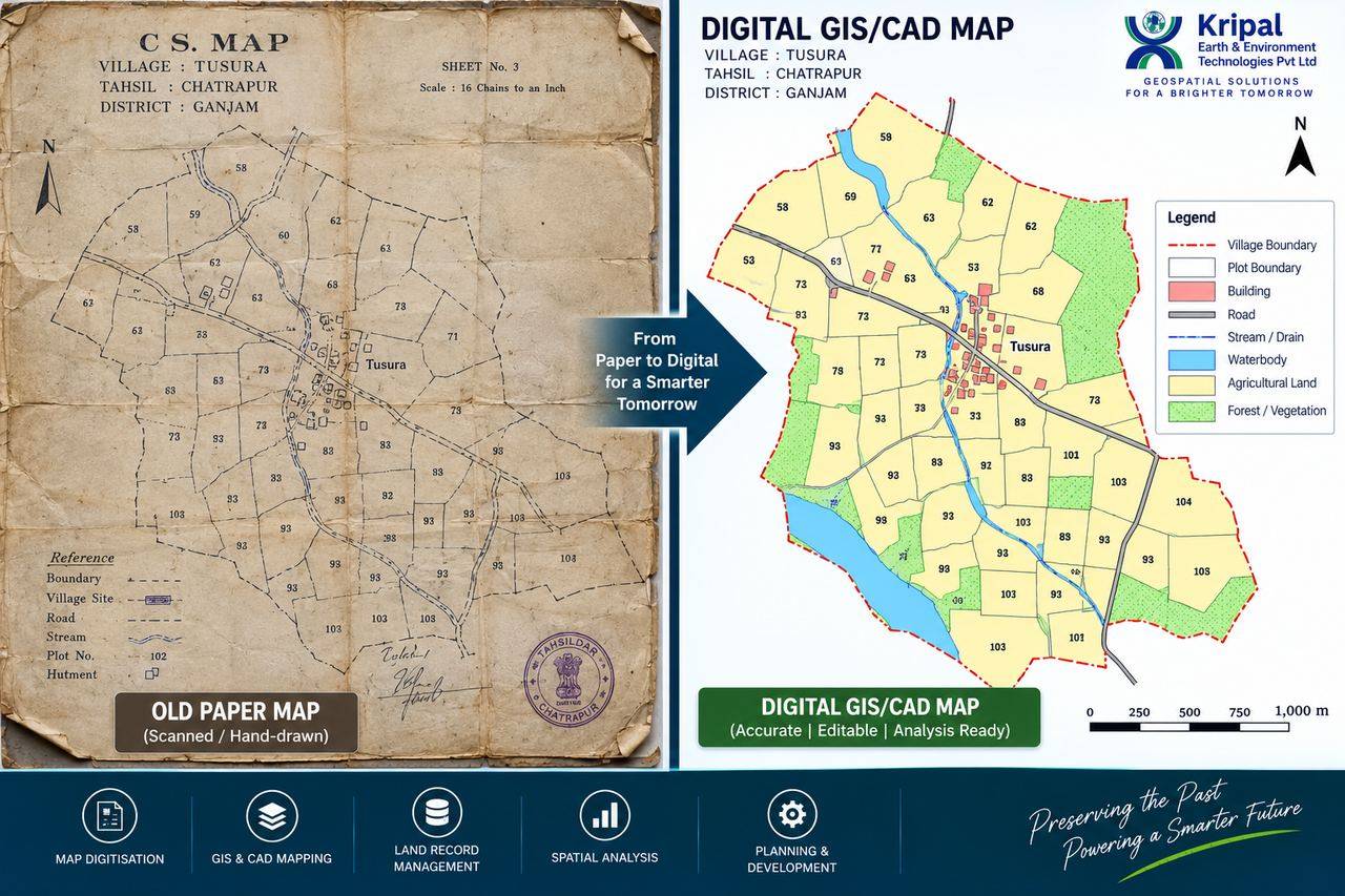
Old cadastral paper map of village Tusura digitised into an editable GIS/CAD mapMAP DIGITISATION

Cadastral Map Digitization — Paper to GIS/CAD

Land Records · Tusura, Chatrapur Tahsil

Legacy CS sheets converted into accurate, editable, analysis-ready GIS/CAD maps with plots, roads, streams and land use layers.

Village-wiseCoverage
EditableGIS + CAD
LegacyCS maps preserved
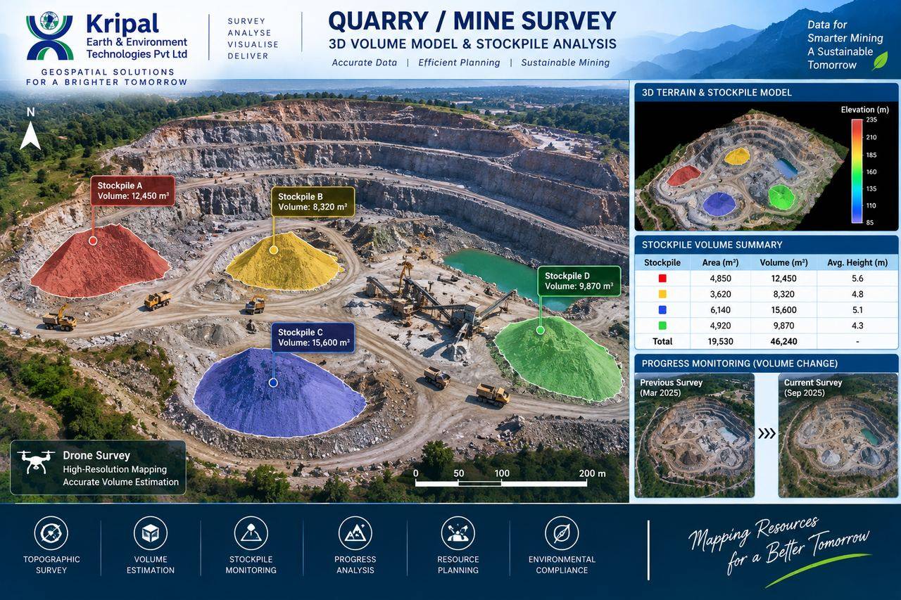
Quarry mine survey with 3D stockpile volume analysisMINE SURVEY

Quarry / Mine Survey & Stockpile Analysis

Mining · Capability Demonstration

Drone-based 3D terrain and stockpile modelling with per-pile volume statements and survey-to-survey progress comparison.

46,240 m³Total volume
4Stockpiles
3DTerrain model
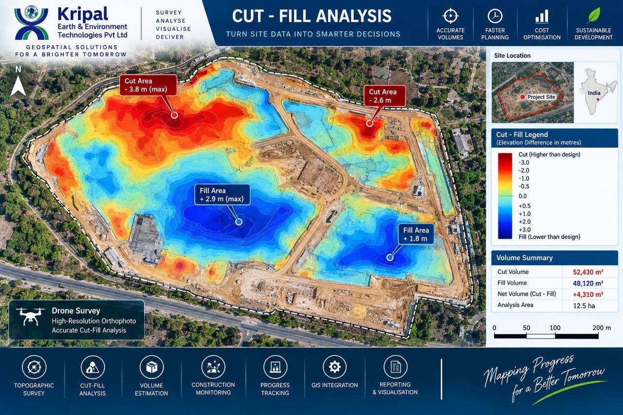
Cut and fill analysis heat map of a construction siteCUT-FILL

Cut & Fill / Earthwork Analysis

Infrastructure · Capability Demonstration

High-resolution orthophoto and surface comparison converting site data into accurate cut, fill and net volume for costing.

52,430 m³Cut
48,120 m³Fill
12.5 haAnalysed
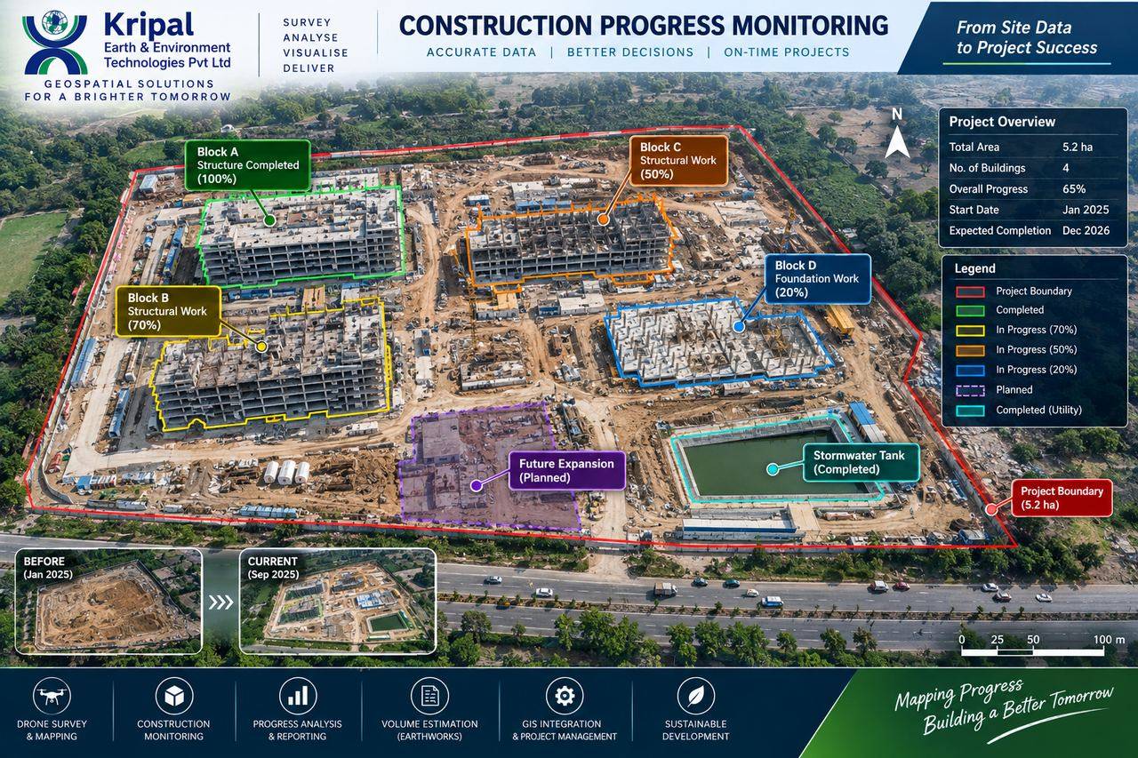
Construction progress monitoring aerial view with block-wise statusPROGRESS

Construction Progress Monitoring

Infrastructure · Capability Demonstration

Periodic drone mapping with block-wise progress overlays, before/after comparison and earthwork quantification for on-time delivery.

5.2 haSite area
4Blocks tracked
65%Progress shown
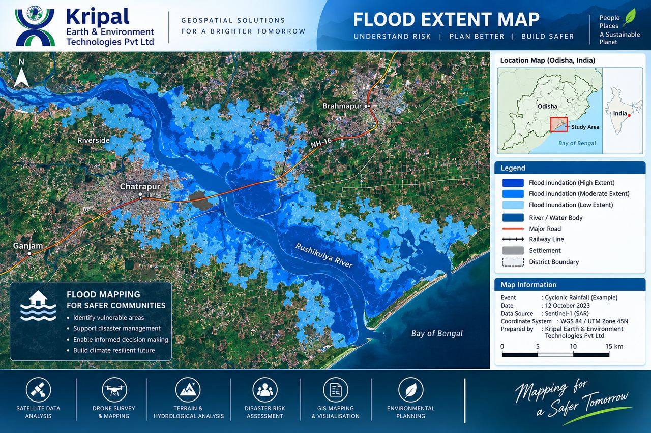
Flood extent map from satellite SAR data over Rushikulya river regionFLOOD MAPPING

Flood Extent & Risk Mapping

Environment · Capability Demonstration

Satellite SAR based flood inundation mapping identifying vulnerable settlements and infrastructure for disaster planning.

SARData source
3 levelsInundation
DistrictScale
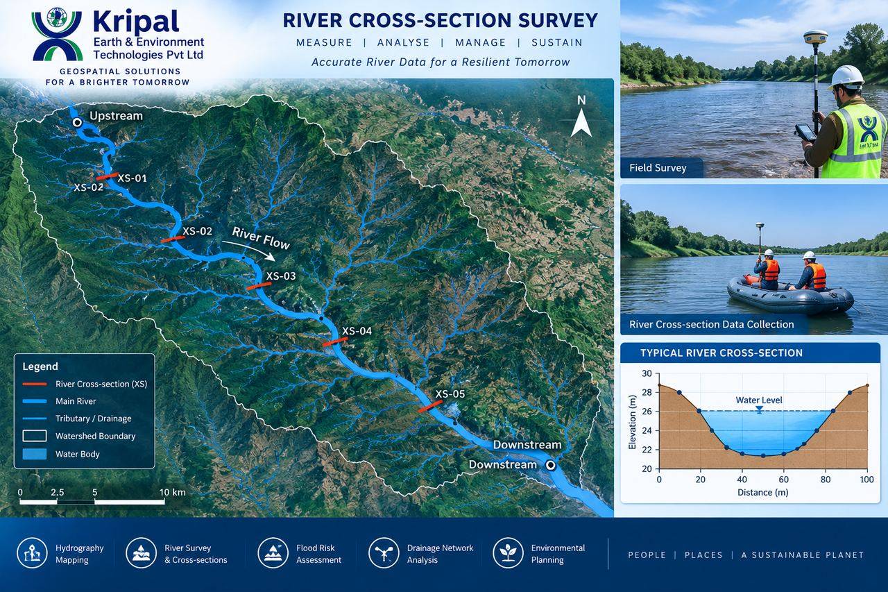
River cross-section survey map with section locations and profileRIVER XS

River Cross-Section Survey

Water Resources · Capability Demonstration

GNSS-controlled river cross-sections with bed profiles and watershed context for hydraulic modelling and flood studies.

5+Sections
GNSSControlled
ProfilePer section
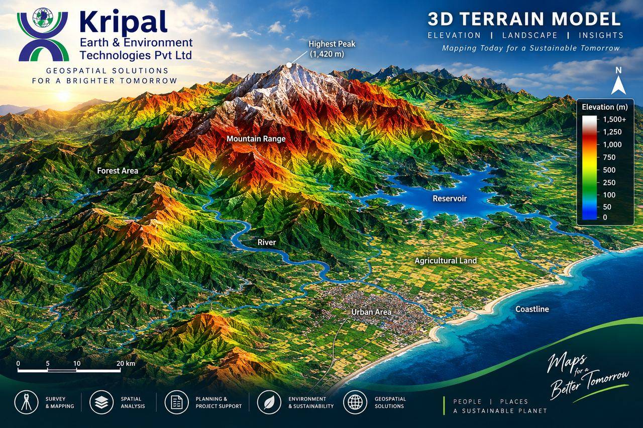
Colour-coded 3D terrain elevation model from mountains to coastline3D TERRAIN

3D Terrain Modelling & Visualization

GIS · Capability Demonstration

Elevation-classified 3D terrain models turning DEM data into intuitive visual insight for planning and communication.

0–1,500 mElevation range
DEMBased
3DVisualization
Case Studies

Situation, approach, outcome — how we deliver

Three engagements that show the full workflow: field acquisition, analytics and the deliverables that decisions were actually made on.

DRONE SURVEY → TOWNSHIP DESIGN

Planning an R&R township from a single drone dataset

Situation
A resettlement & rehabilitation township needed rapid, defensible planning across ~888 acres — with terrain-aware plot layout and drainage design.
Approach
Drone survey with DGPS control producing ~19 cm DTM/DSM; hydrological D8 drainage analysis; suitability zoning; automated plot subdivision with internal road network.
Outcome
Complete plan: 871 uniform plots with road access and drainage-aware layout, delivered as GIS + CAD.
888 acMapped
871Plots planned
19 cmDTM resolution
URBAN GOVERNANCE → GIS-MIS

A working GIS-MIS for an urban local body

Situation
Chatrapur NAC needed its assets, POIs and boundaries as structured spatial data — plus standardized maps its administration could actually use and reproduce.
Approach
POI extraction and boundary mapping to a consistent schema; QGIS Atlas-based cartographic templates; GIS-Android field integration proposed in NAC administrative formats.
Outcome
An NAC-wide GIS-MIS foundation with repeatable map production — built for government workflows, not around them.
NAC-wideCoverage
AtlasMap templates
MobileField-ready
FORESTRY → MULTI-EPOCH AI

Measuring plantation survival, tree by tree

Situation
A forestry client needed to verify plantation survival and growth objectively — beyond sample-plot estimates — across large sites.
Approach
Two drone epochs (post-pitting and post-plantation) with AI-assisted analysis: crown delineation, canopy height models, gap detection and change detection.
Outcome
Per-tree survival and growth statistics by compartment, with full forestry deliverables from orthomosaic to technical report — priced per epoch, all-inclusive.
2 epochsCompared
Per-treeMetrics
CHM+ crown maps
Clients & Partners

Trusted by organizations across government and industry

Training & Capacity Building

Learn from people who do this for a living

Our instructors are the same professionals who fly our missions and build our platforms. Every program uses real project datasets — not textbook samples.

GIS & Remote Sensing Fundamentals

FoundationQGIS · coordinate systems · spatial analysis · map production

Drone Survey & Photogrammetry

ProfessionalFlight planning · GCPs · processing · orthomosaic & DEM QC

LiDAR Data Processing

AdvancedPoint cloud classification · DTM extraction · forestry metrics

Web GIS Development

ProfessionalPostGIS · Leaflet/OpenLayers · publishing map services

Spatial Data Science with Python

AdvancedSatellite time-series · LULC classification · Python & GDAL workflows

Advanced QGIS & Cartography

ProfessionalSpatial databases · model builder · print layouts & atlases
FAQ

Questions clients ask before engaging us

How accurate is a drone survey compared to a traditional survey?
With a properly designed DGPS ground control network, drone photogrammetry typically achieves ±5–10 cm positional accuracy — sufficient for planning, volumes and most engineering uses. For legal boundaries and design-critical points, we combine drone data with DGPS/Total Station measurements, and every project ships with a check-point accuracy report so you can verify the numbers yourself.
What do I actually receive at the end of a mapping project?
Standard open formats: GeoTIFF orthomosaics, LAS/LAZ point clouds, DEM/DTM rasters, contours and features in DWG/Shapefile/GeoJSON, plus PDF map series and a technical report with QC documentation. If you need the data in a specific departmental or CAD template, we deliver to that specification.
Are your drone operations compliant with Indian regulations?
Yes. Flights are planned and conducted in line with DGCA Drone Rules, including airspace zone checks and required permissions. Compliance planning is built into our project scoping stage, not treated as an afterthought.
Can you handle both the survey and the software?
That's our core strength. The same team that acquires and processes your data can build the Web GIS portal, MIS dashboard or mobile app your staff will use it in — which means no data-format friction between vendors and one point of accountability.
How is pricing structured?
Mapping projects are quoted per site based on area, terrain, accuracy requirement and deliverables. Recurring monitoring (mining, construction, plantations) is quoted per epoch with an all-inclusive rate. Software projects are scoped by modules and milestones. Send us your requirement and we'll return a clear, itemized quotation.
Do you work outside Odisha?
Yes — our field teams are mobile and we execute projects across India. Data processing, GIS and software development are handled from our Bhubaneswar office regardless of site location.
Insights

Perspectives from the field

Practical writing on geospatial workflows in India — the kind of guidance we wish existed when we started. New articles publish regularly.

Drone, GNSS survey and GIS analysis workflow

How many ground control points does your drone survey actually need?

GCP design decides whether your accuracy report passes review. A practical framework by site size and terrain.

Read article →
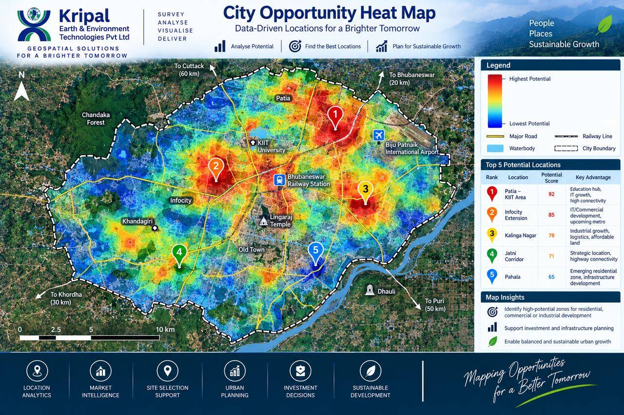
City opportunity heat map built from GIS analysis

What a GIS-MIS really needs to work inside an urban local body

Lessons from municipal deployments: data schemas, map templates and workflows that survive staff transfers.

Read article →
Plantation and green cover mapping from drone survey

Counting every tree: multi-epoch drone analytics for plantation monitoring

How two flight epochs plus AI crown detection replace sample-plot guesswork with per-tree survival data.

Read article →

Build your career at the intersection of field and code

We hire surveyors, GIS analysts, drone pilots and developers who want their work to reach the ground. If that's you, we'd like to hear from you.

Join Our Team

Have a project in mind?

Send us the site, the question you need answered, and the deadline. We'll respond with an approach, timeline and itemized quotation.

Free consultation · Service orders · After-delivery support

Contact

Let's connect

Tell us about your project — our team responds with a tailored approach, timeline and quotation, usually within one working day.

  • HEAD OFFICEPlot No. 222/1068/2132, Brundavan Garden, Kolothia, Bhubaneswar, Odisha
  • REGISTERED OFFICEPlot No. 475, Upper Bhoi Sahi, Laxmi Sagar, Bhubaneswar – 751006, Odisha
  • EMAILinfo@ke2technologies.com
  • PHONE / WHATSAPP+91 93374 54754
  • HOURSMon – Sat · 9:30 AM – 6:30 PM IST

Chat on WhatsApp

Faster quotes: if you can, include the site location (or a KML), approximate area or corridor length, required accuracy, and the deliverables you need. That's usually everything we need to price it.

Your enquiry is saved instantly and our team is notified by email.

Chat on WhatsApp