Where LiDAR is the right tool
Vegetated corridors, forested watersheds and canal alignments hide the ground from cameras. LiDAR pulses penetrate gaps in the canopy and return true ground elevations, producing the bare-earth DTM that road, rail, canal and transmission designers actually need.
Our corridor workflow — flight planning, control, point-cloud classification, breakline extraction and contour generation — delivers directly into alignment design software as DWG and LandXML-compatible outputs.
Classification you can audit
Every point cloud is classified (ground, vegetation classes, buildings, water) to project specification and delivered as LAS/LAZ with a classification report. We process in open toolchains (PDAL, CloudCompare), so nothing about your data is locked to a vendor.
LiDAR + imagery together
Most projects pair LiDAR with simultaneous imagery: the ortho gives context and feature capture; the LiDAR gives terrain truth. One mobilization, two complementary datasets, a single accountable partner.
Deliverables you receive
- Classified point cloud (LAS/LAZ) with classification report
- Bare-earth DTM & DSM rasters
- Contours at design interval (0.25–1 m) as SHP/DWG
- Corridor strip maps with chainage
- Cross-sections & longitudinal profiles
- Feature inventory: culverts, bridges, junctions, crossings
Specifications & standards
| Parameter | What we deliver |
|---|---|
| Point density | Project-specified; typical 50–300 pts/m² |
| Vertical accuracy | Better than 10 cm on hard surfaces (reported) |
| Classification | ASPRS classes to project spec |
| Under-canopy DTM | Yes — primary LiDAR advantage |
| Outputs | LAS/LAZ, GeoTIFF, SHP, DWG, LandXML-compatible |
| Toolchain | Open-source (PDAL, CloudCompare) — no vendor lock-in |
Recent work
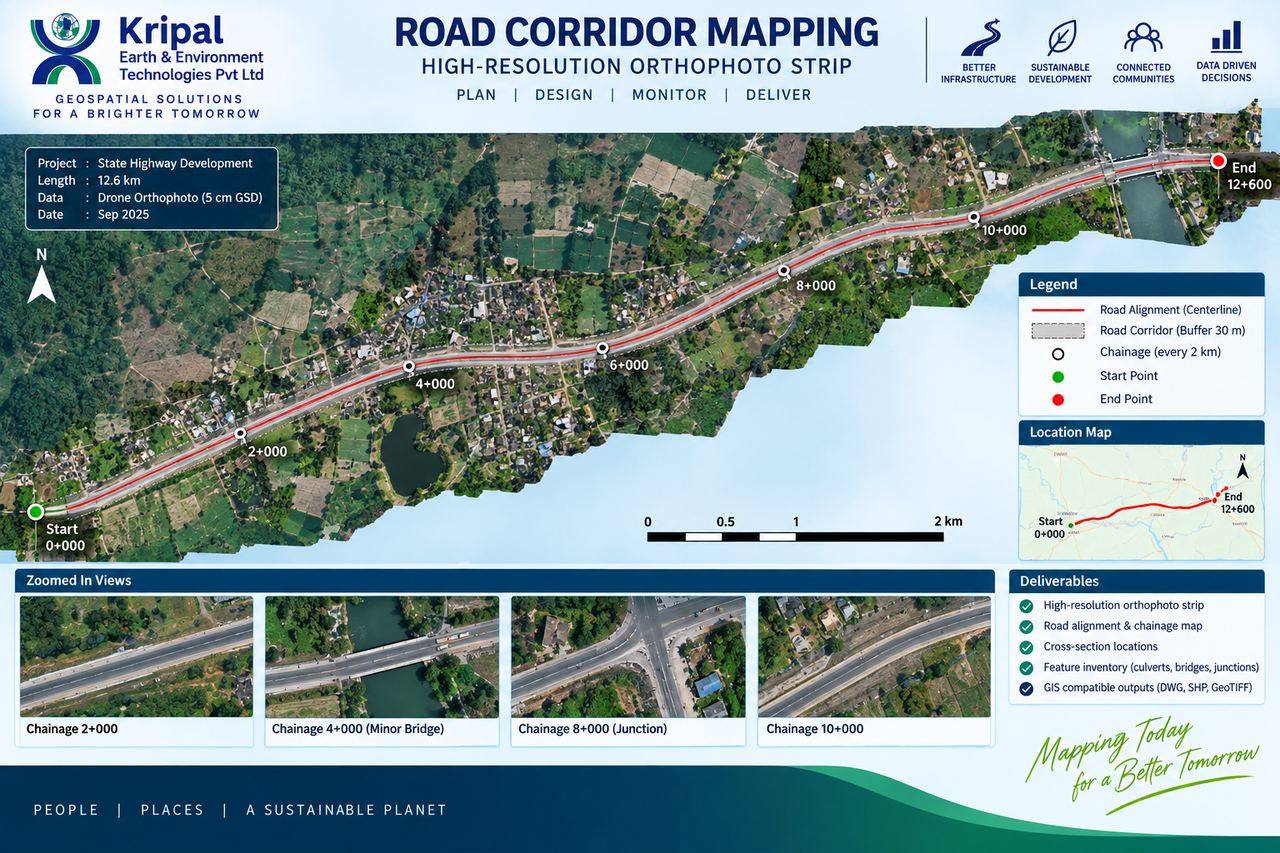 Highway Corridor Mapping — 12.6 km
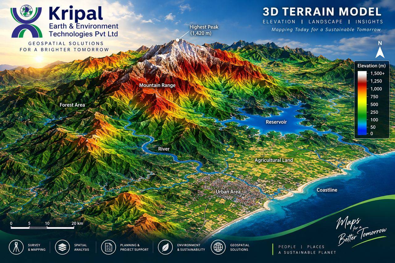 3D Terrain Modelling
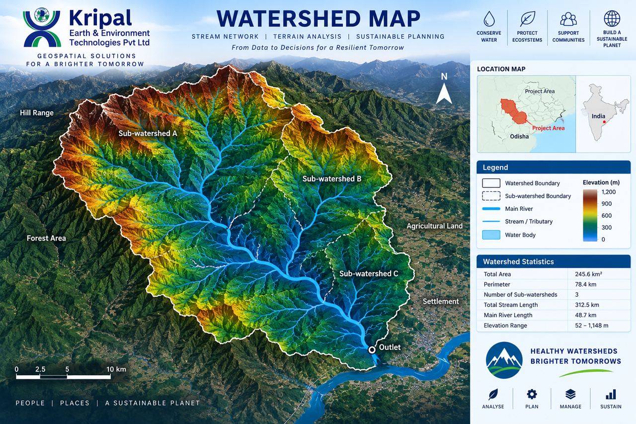 Watershed & Stream Network Analysis