Control is everything
Every accurate map begins on the ground. We establish DGPS control networks tied to national reference frames, densified with total-station traverses where canopy or construction blocks sky view — the same control that anchors our drone and LiDAR missions and stands scrutiny in audits and disputes.
Boundary, cadastral and plot work
Village-map digitization, plot demarcation, R&R plot layouts and possession surveys — combining legacy cadastral records (we digitize old CS sheets into editable GIS/CAD) with on-ground DGPS verification, so paper, database and ground finally agree.
Topographic & engineering surveys
Contour surveys for site development, L-sections and cross-sections for roads, canals and drains, river cross-sections for hydraulic studies, and as-built verification — delivered as clean DWG/SHP with survey reports your consultants accept without rework.
Deliverables you receive
- DGPS control network with station descriptions & accuracy report
- Topographic survey plans (DWG/SHP) with contours
- Plot demarcation & boundary survey records
- L-sections, cross-sections and profiles
- Cadastral map digitization (paper → GIS/CAD)
- Survey report suitable for tender/department submission
Specifications & standards
| Parameter | What we deliver |
|---|---|
| DGPS accuracy | Centimetre-grade (static/RTK as required) |
| Traverse | Total-station closed traverses, adjusted |
| Datum | WGS84 / UTM; local grids on request |
| Records | Field books, station photos, control descriptions |
| Team | Licensed surveyor-led field crews |
| Outputs | DWG, SHP, CSV coordinates, PDF plans |
Recent work
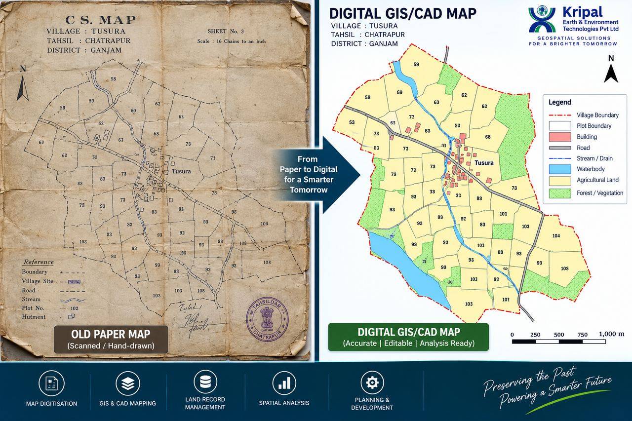 Cadastral Map Digitization — Tusura
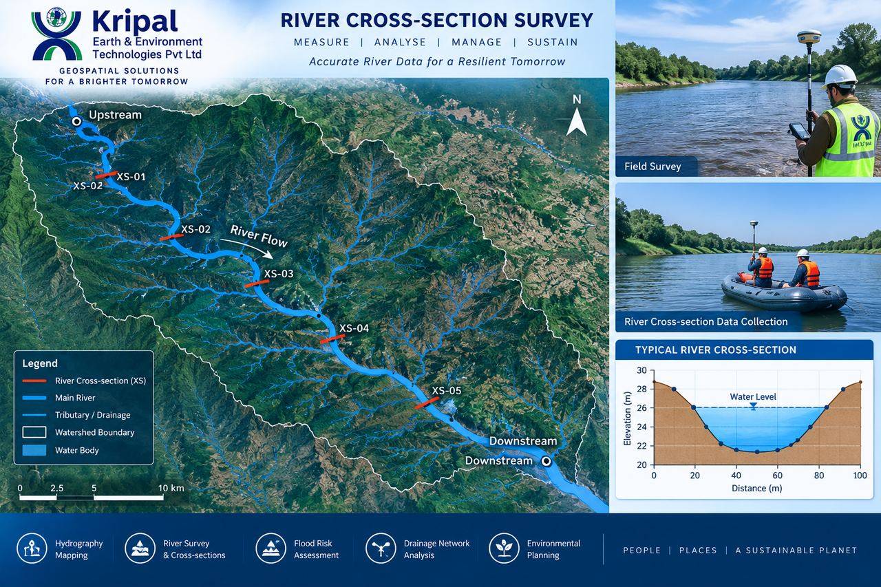 River Cross-Section Survey
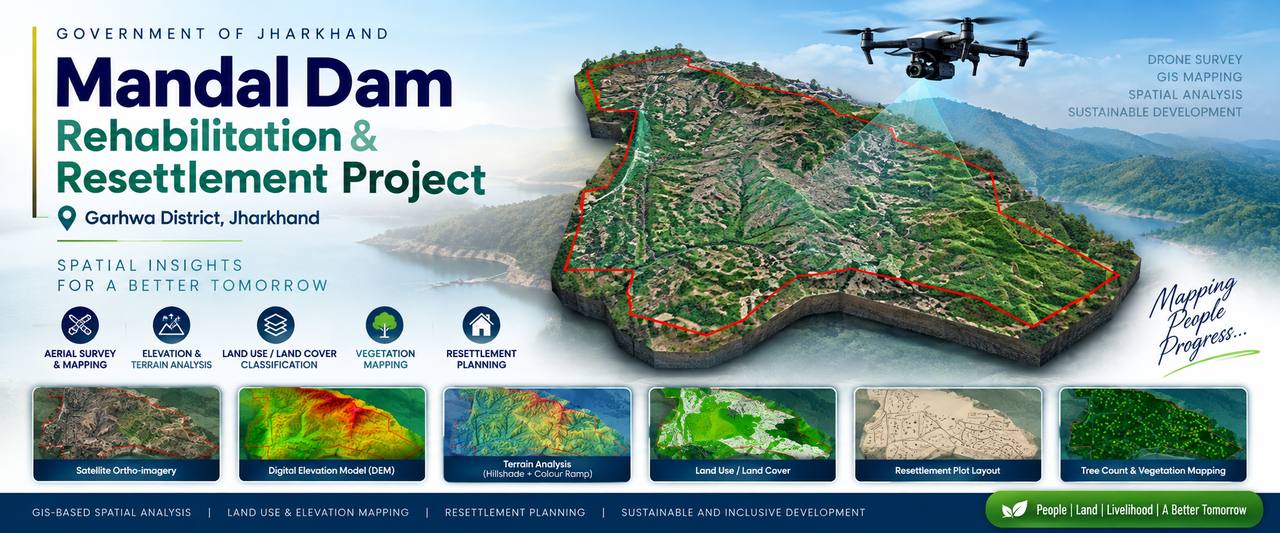 R&R Plot Subdivision — 871 plots